The rapid development of El Niño in 2026 is expected to significantly alter weather patterns across the globe. This phenomenon, part of the ENSO cycle, is already showing signs of becoming a Super El Niño by the latter half of the year.
A powerful oceanic Kelvin wave has intensified, effectively ending a multi-year La Niña influence that had dominated global weather. The latest models from ECMWF and UKMO indicate a stronger El Niño signature in Summer 2026 than previously anticipated.
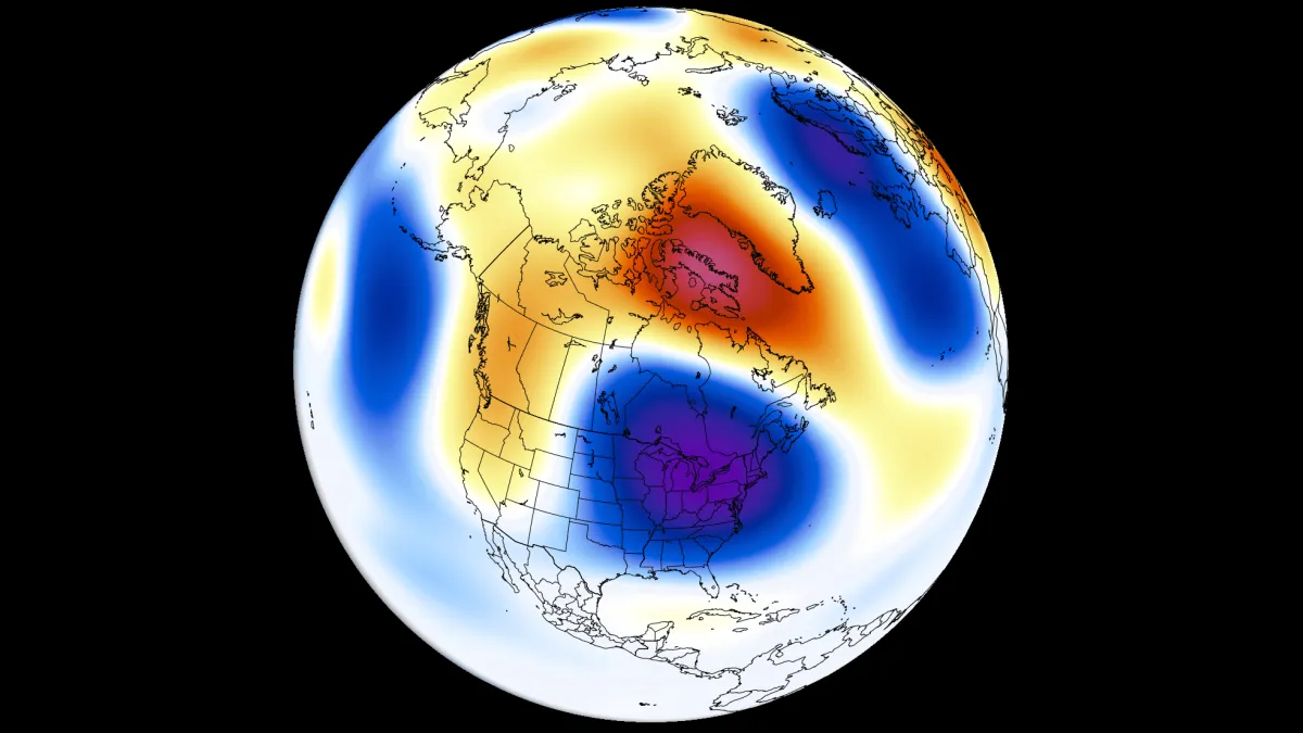
Forecasted impacts include:
- A low-pressure area over eastern Canada and the northeastern United States.
- Above-normal temperatures across the northwestern United States and western Canada.
- Increased rainfall expected over the western, central, and northeastern United States, as well as the Midwest and southeastern Canada.
- Decreased precipitation projected for the far southern United States and southern and central Canada.
Residents in affected areas are preparing for potential disruptions. In Seattle, local farmer Jane Thompson expressed concern: “We depend on consistent weather for our crops. Any significant changes could hurt our harvests this year.” Meanwhile, families in New York are bracing for heavier rainfall that could lead to flooding.
The ENSO cycle typically alternates between warm and cold phases every 1-3 years, but this rapid transition raises questions about how long these effects will last. While predictions are being made, uncertainties remain regarding the overall strength and duration of this Super El Niño.
As communities gear up for these changes, officials continue to monitor developments closely. The next update from meteorological agencies is expected later this month as they refine their forecasts based on evolving data.